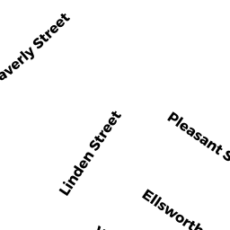
6 LINDEN ST
Owner Information
None
4-6 LINDEN ST
EVERETT, MA 02149


Property Details
6 LINDEN ST is classified as a Two-Family Residential (Multi 2 fam).
The primary structure on this property was built in 1910. There are 3,046ft2 of built area within this property. There is 2,099ft2 of residential/living space within this property. This property is listed as having 11 rooms. There are 2 units within this property.
6 LINDEN ST is valued at $543,300. The land is valued at $173,900 and the structures are valued at $369,400.
This property is in Zone DD. Confirm with local Zoning Board authorities to ensure there are no overlays or other easements on this property.
The most recent deed for 6 LINDEN ST is recorded at the local registrar in Book 76467, Page 215. 6 LINDEN ST was last sold on Friday, December 18, 2020 for $1.
Assessment data from fiscal year 2022.
Flood Data
According to the FEMA National Flood Hazard Layer, this property does not appear to be in a flood zone. It may also be in an area not yet reviewed. Nonetheless, confirm this information prior to taking any action.
To view the flood hazards around this property, create a FEMA "Firmette" Map of the area around 6 LINDEN ST.
Broadband Internet Providers
| Provider | Type | Bandwidth (mbps) | |
|---|---|---|---|
| netBlazr Inc | Fixed Wireless | 50 | 50 |
| Starry, Inc. | Fixed Wireless | 200 | 200 |
| Comcast | Cable | 1000 | 35 |
| Verizon New England Inc. | DSL | 5 | 0 |
| Crown Castle Fiber | Fiber | 0 | 0 |
| Viasat Inc | Satellite | 100 | 3 |
| RCN | Cable | 1000 | 20 |
| RCN | Cable | 500 | 20 |
| VSAT Systems, LLC. | Satellite | 2 | 1 |
| HughesNet | Satellite | 25 | 3 |
| GCI Communication Corp. | Satellite | 0 | 0 |
Broadband service provider data from December 2020.
Adjacent Properties
- 233 MAIN ST
Two-Family Residential owned by None - 229 MAIN ST
Two-Family Residential owned by MORALES BIANCA A - 225 MAIN ST 1
Residential Condominium owned by ZHOU DANDAN - 225 MAIN ST 2
Residential Condominium owned by SMITH SERENA HUILAN KAINI - 225 MAIN ST 3
Residential Condominium owned by GALLAGHER LAUREN - 225 MAIN ST
Other, Non-Taxable Condominium Common Land owned by None - 10 LINDEN ST
Two-Family Residential owned by None